This project returns to the QGIS map of Prince Edward Island I worked with previously in Optional Project 32. The first step in this continuation was to add a new raster layer in which to include the new map.
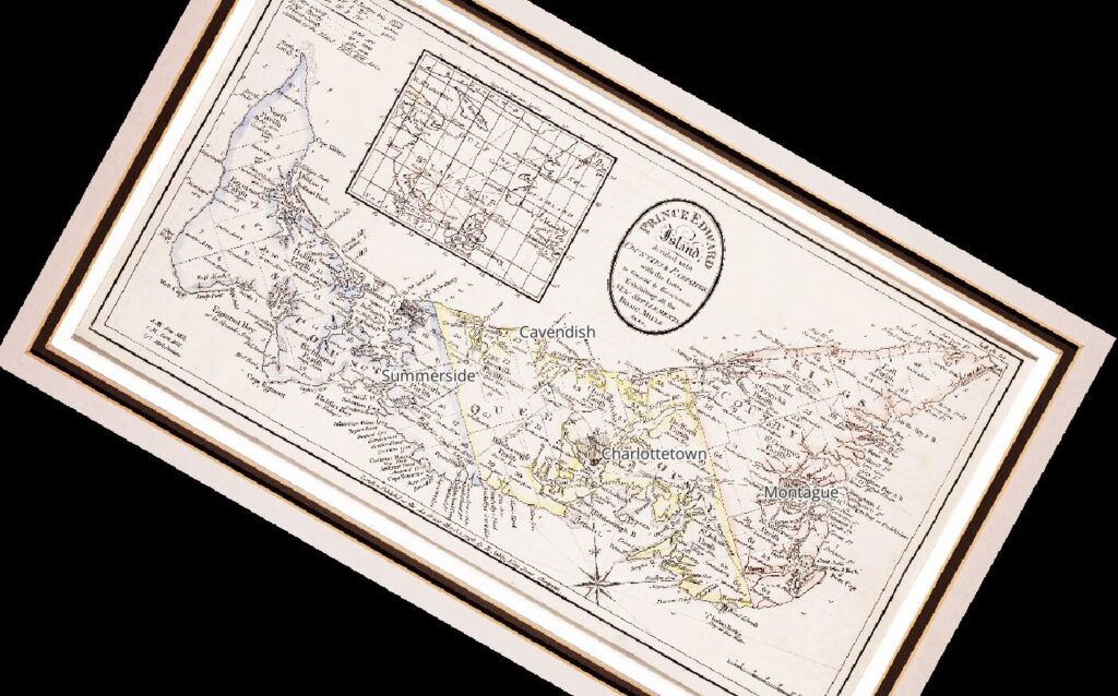
After getting the new map set up (which involved some inconclusive alterations to the settings; I’m not entirely sure they worked as intended), I had a new version of the map which was just a little crooked.
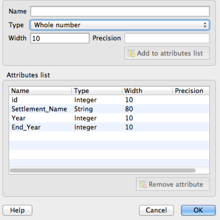
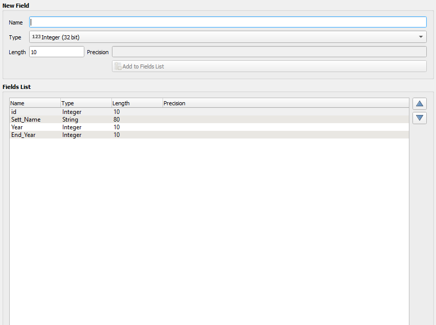
The next step was to add in a new vector layer. This became a problem because, as with the previous QGIS project, the Programming Historian’s guide is out of date and no longer representative of the way QGIS currently works. Some items were renamed and (strangely) it seems that a character limit was introduced into one of the data fields, which is why “Settlement_Name” had to become “Sett_Name.” See their version and mine below.
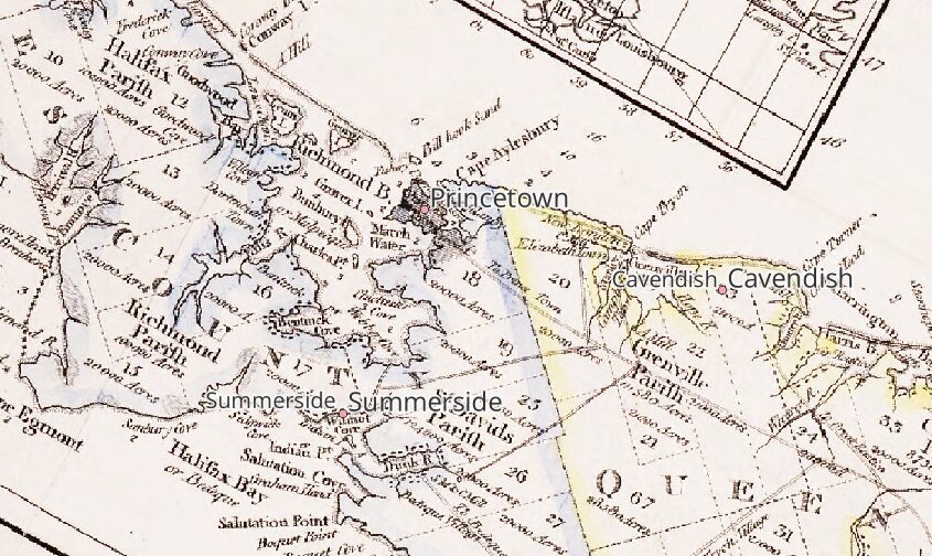
After this point, I needed to manually enter a number of new points on the map, recording the founding (and in some cases end dates) of several towns across Prince Edward Island. I also stepped outside of the instructions as before to make the place names a little more readable.
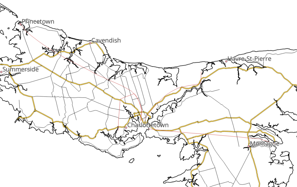
The next step was to trace some of the original roads from 1798 for a comparison to the modern ones provided in the government map of the island. There were some differences, to say the least, although my hideous misrepresentation of Charlottetown’s location is probably not helping matters.
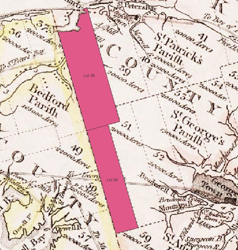
The final segment had me drawing out some lots on the island to demonstrate the polygon tool (and the snap feature associated with it). This turned out to be a much easier task than I had anticipated. I wasn’t able to get that last piece of Lot 38 included, however, thanks to the bay and spent a long time trying to figure out how to do so. I’ll probably return to the program later to keep working on that.