Google Maps
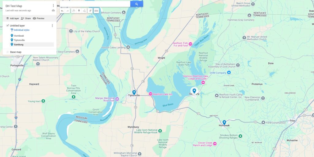
This project follows the use of data sets in Google Maps and Google Earth. Once I had my account settings sorted out and a test map pulled up, I selected a trio of towns which I’ve been researching recently and “added” them to my map.
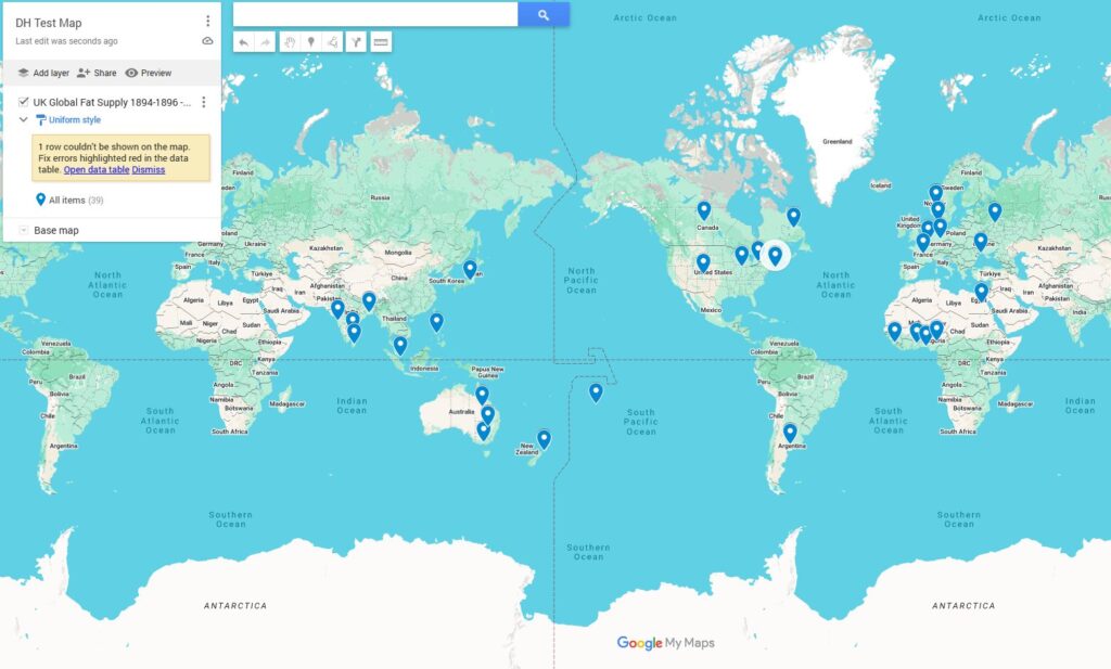
Deleting those test items, I went forward with the provided dataset. This spreadsheet provides data on the British sources for “fats” (mainly oils) from the period of 1894 – 1896.
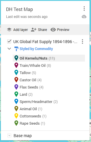
My next task was to change the style to “by commodity,” but I ran into a bit of trouble here. The Programming Historian lesson appears to be on a different version of this software than I am, so it took a minute to work out the layout. Mine ended up looking like this.
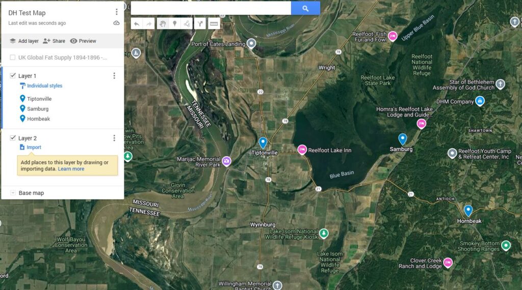
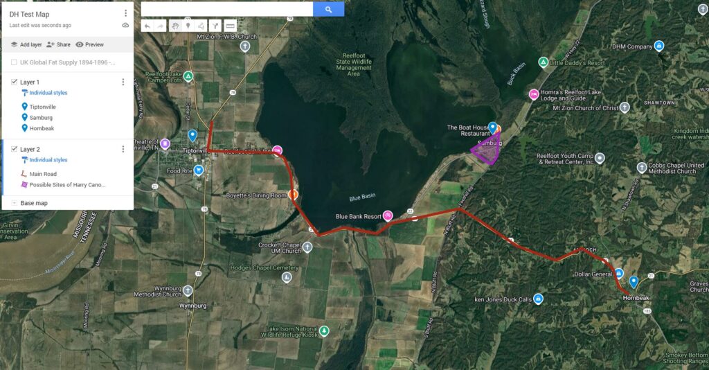
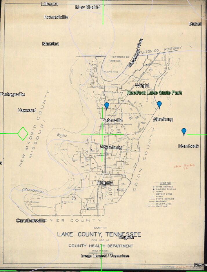
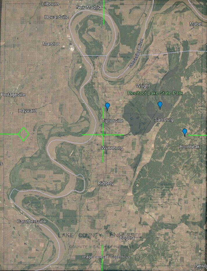
The next set of instructions had me swap the base map to a satellite image and put down some place markers, so I returned to the same set of towns from the beginning of this project.
In the next layer, I was to trace a road and add a polygon. I followed the main road going between Tiptonville and Hornbeak and outlined the rough site of a saloon I’ve been tracking the location of.
Google Earth
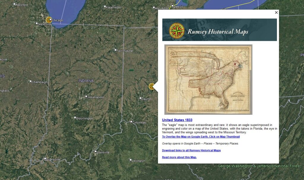
Getting started on Google Earth was quite freeform. I was encouraged to look around and familiarize myself with the settings, including the option for historical maps.
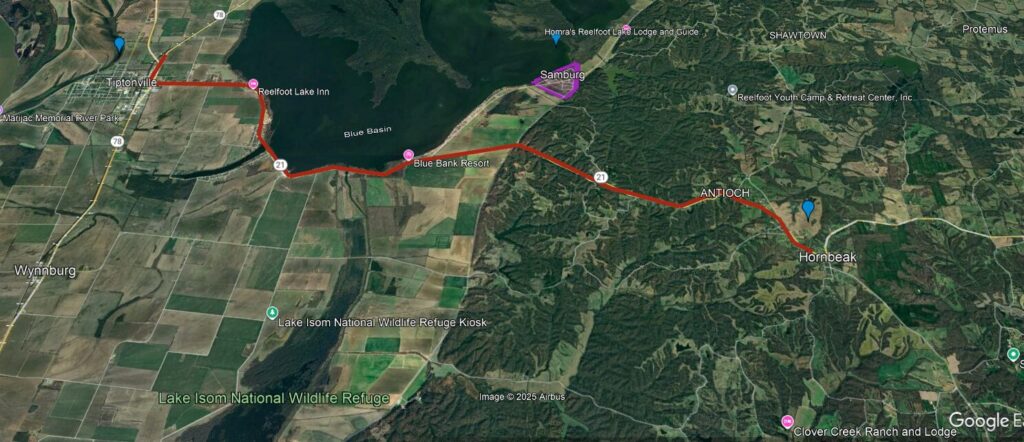
After this, I moved on to KML files. I exported the text map I made during the Google Maps section as one such file and applied it into my Google Earth application. The file now appeared in 3d on my Google Earth.
At this stage, the Programming Historian lesson had a polygon to place around Lake St. Claire near Detroit. Helpfully, Lake County, Tennessee also contains a lake of some note (Reelfoot), which I outlined with my own polygon as seen below.
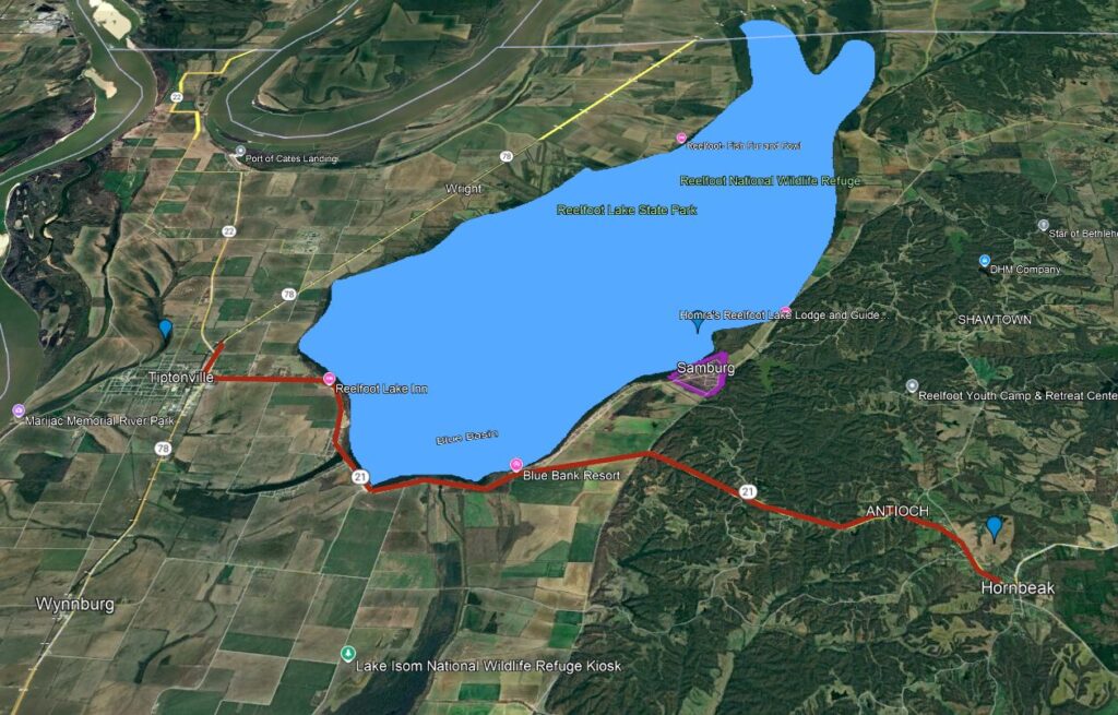
The last item was to overlay a historic map onto the Earth project. I tracked down a 1930’s map of Lake County and (with substantial difficulty) abused it into mostly fitting the satellite imagery. The town of Samburg has been plunged into Reelfoot Lake, but I’ve been told it wasn’t terribly impressive to begin with.
Once saved, that was the end of the Google Maps/Earth training on Programming Historian. The lesson was interesting and I see plenty of uses for these programs, particularly on collaborative projects. The ability to share marked-up maps with one another will be invaluable in such a context.